Media
Image
Media Name
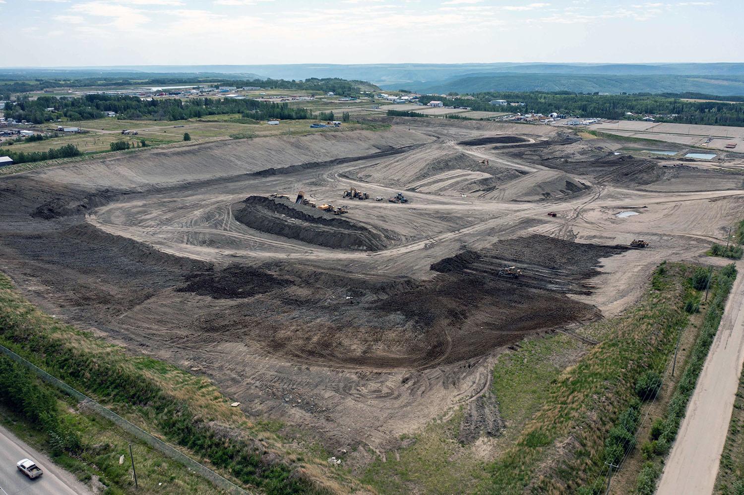
The 85th Avenue Industrial Lands, where the glacial till used to build the dam is extracted and transported by conveyor to site. | June 2023
Caption
The 85th Avenue Industrial Lands, where the glacial till used to build the dam is extracted and transported by conveyor to site. | June 2023
Media
Image
Media Name
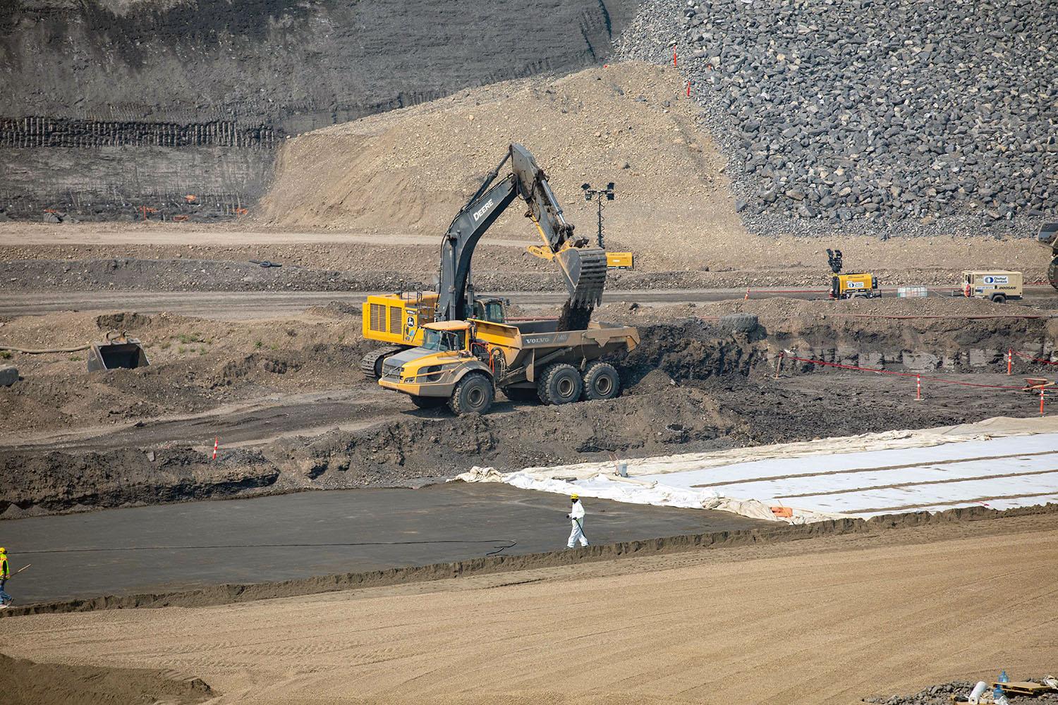
Digging down to bedrock in the approach channel. | June 2023
Caption
Digging down to bedrock in the approach channel. | June 2023
Media
Image
Media Name
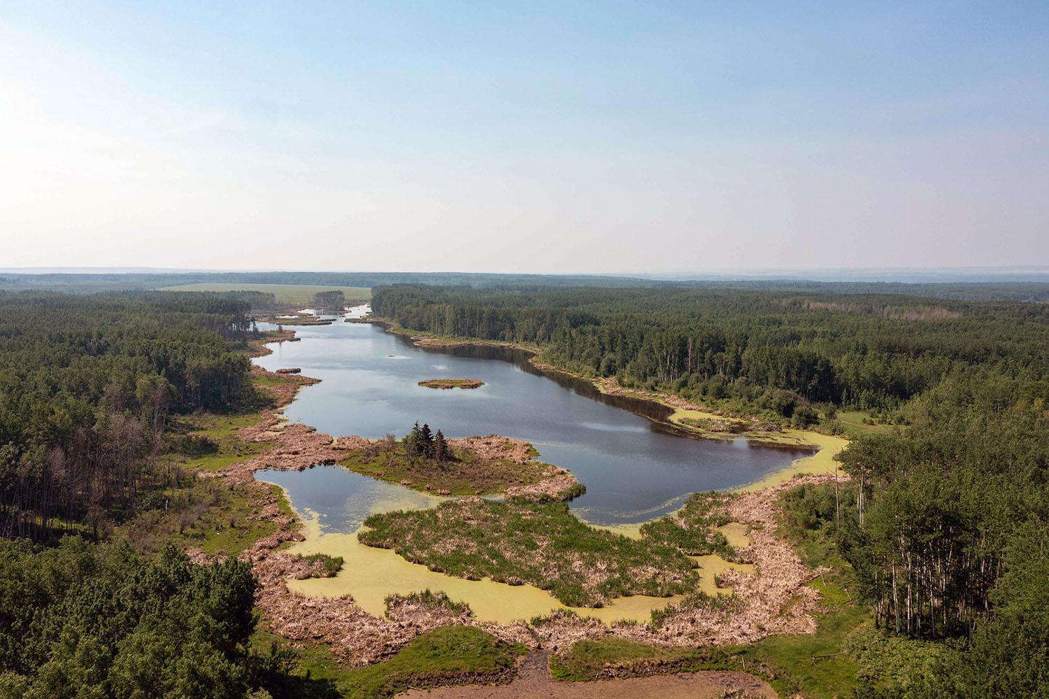
BC Hydro re-built the dam infrastructure to restore the 42-acre Doig-Beatton wetlands, as part of Site C’s habitat compensation program. | June 2023
Caption
BC Hydro re-built the dam infrastructure to restore the 42-acre Doig-Beatton wetlands, as part of Site C’s habitat compensation program. | June 2023
Media
Image
Media Name
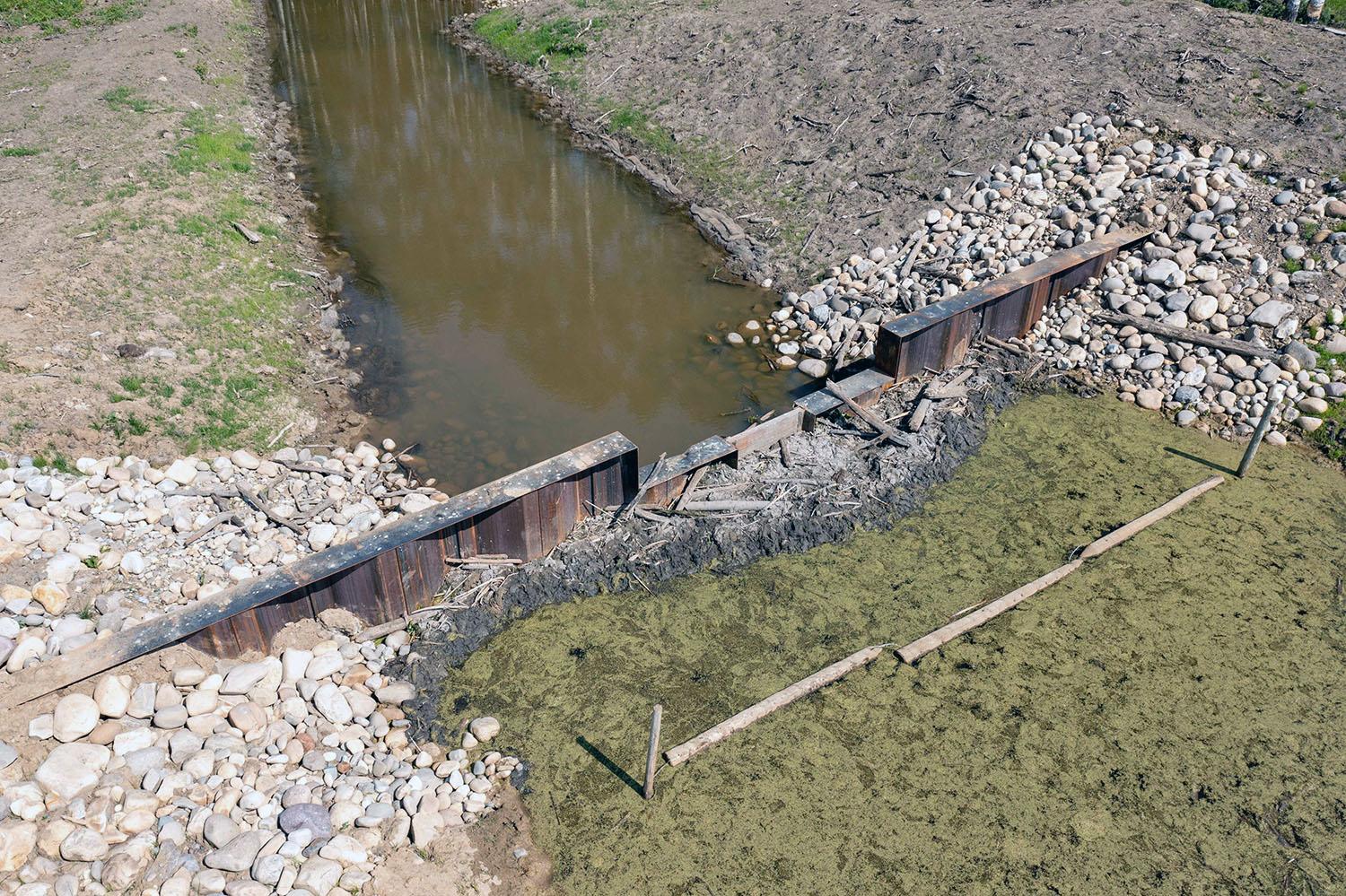
The weir structures in the Doig-Beatton wetland were created in 1989 with an expected lifespan of 30 years. BC Hydro funded Ducks Unlimited to rebuild and preserve the wetland to avoid the loss of important wildlife habitat. | June 2023
Caption
The weir structures in the Doig-Beatton wetland were created in 1989 with an expected lifespan of 30 years. BC Hydro funded Ducks Unlimited to rebuild and preserve the wetland to avoid the loss of important wildlife habitat. | June 2023
Media
Image
Media Name
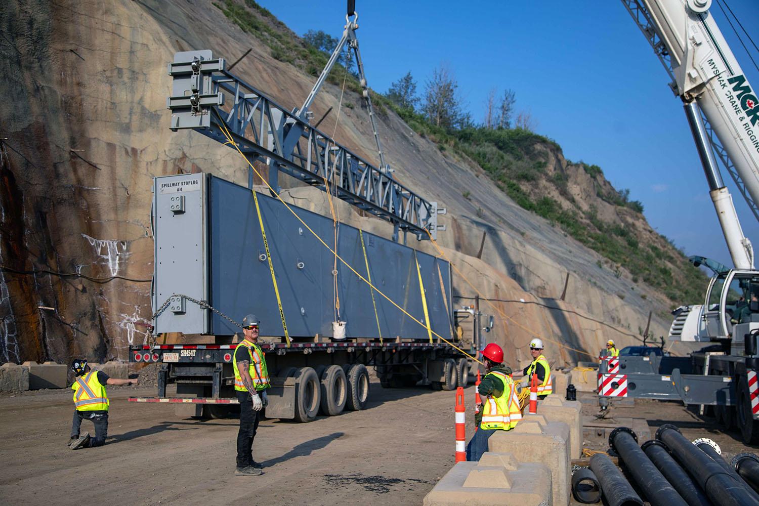
Stoplogs are the hydraulic engineering control used to stop the flow of water at the outlet of Diversion Tunnel 2. | June 2023
Caption
Stoplogs are the hydraulic engineering control used to stop the flow of water at the outlet of Diversion Tunnel 2. | June 2023
Media
Image
Media Name
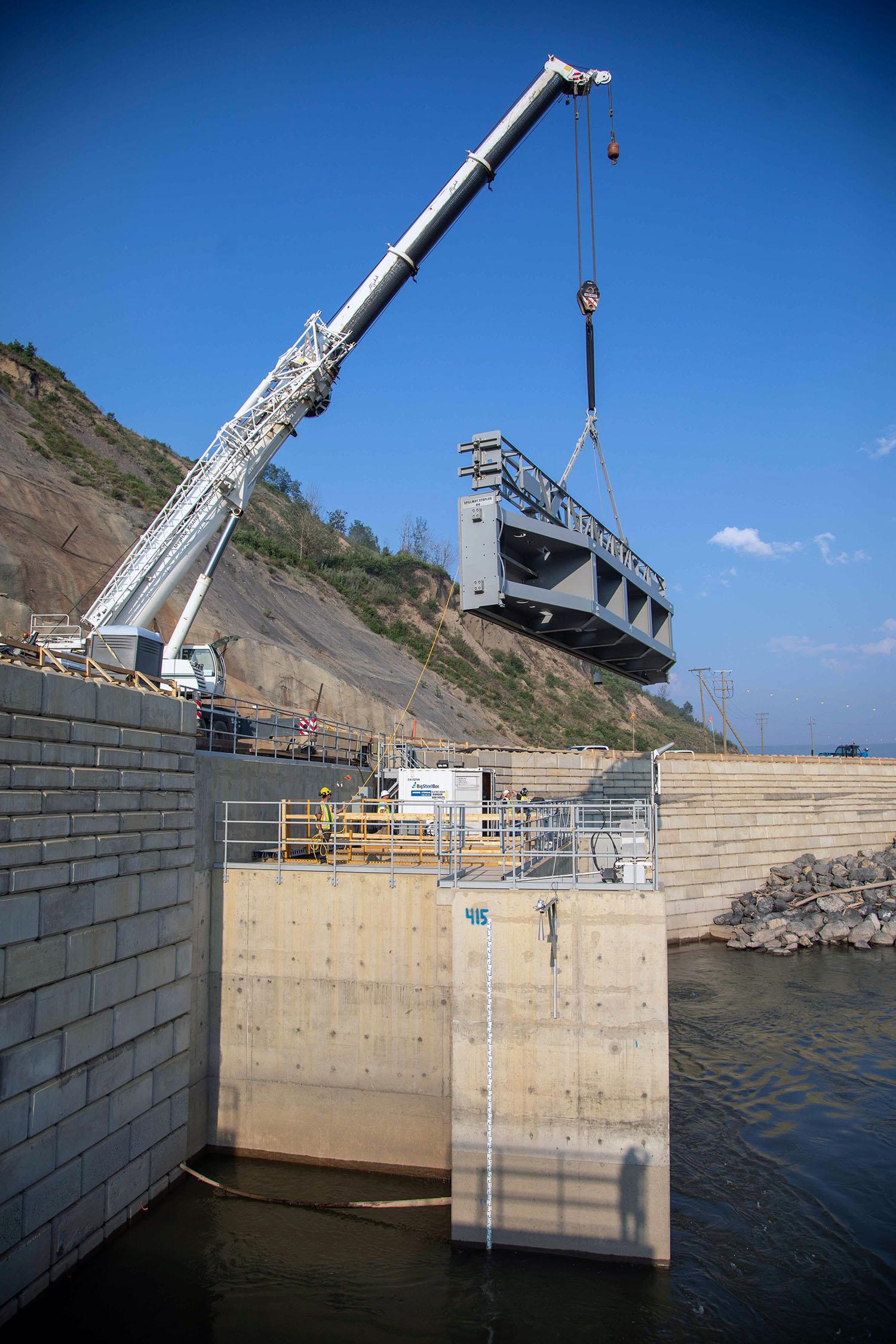
The last of eight stoplogs is lowered over the outlet of Diversion Tunnel 2 to seal the tunnel. | June 2023
Caption
The last of eight stoplogs is lowered over the outlet of Diversion Tunnel 2 to seal the tunnel. | June 2023
Media
Image
Media Name
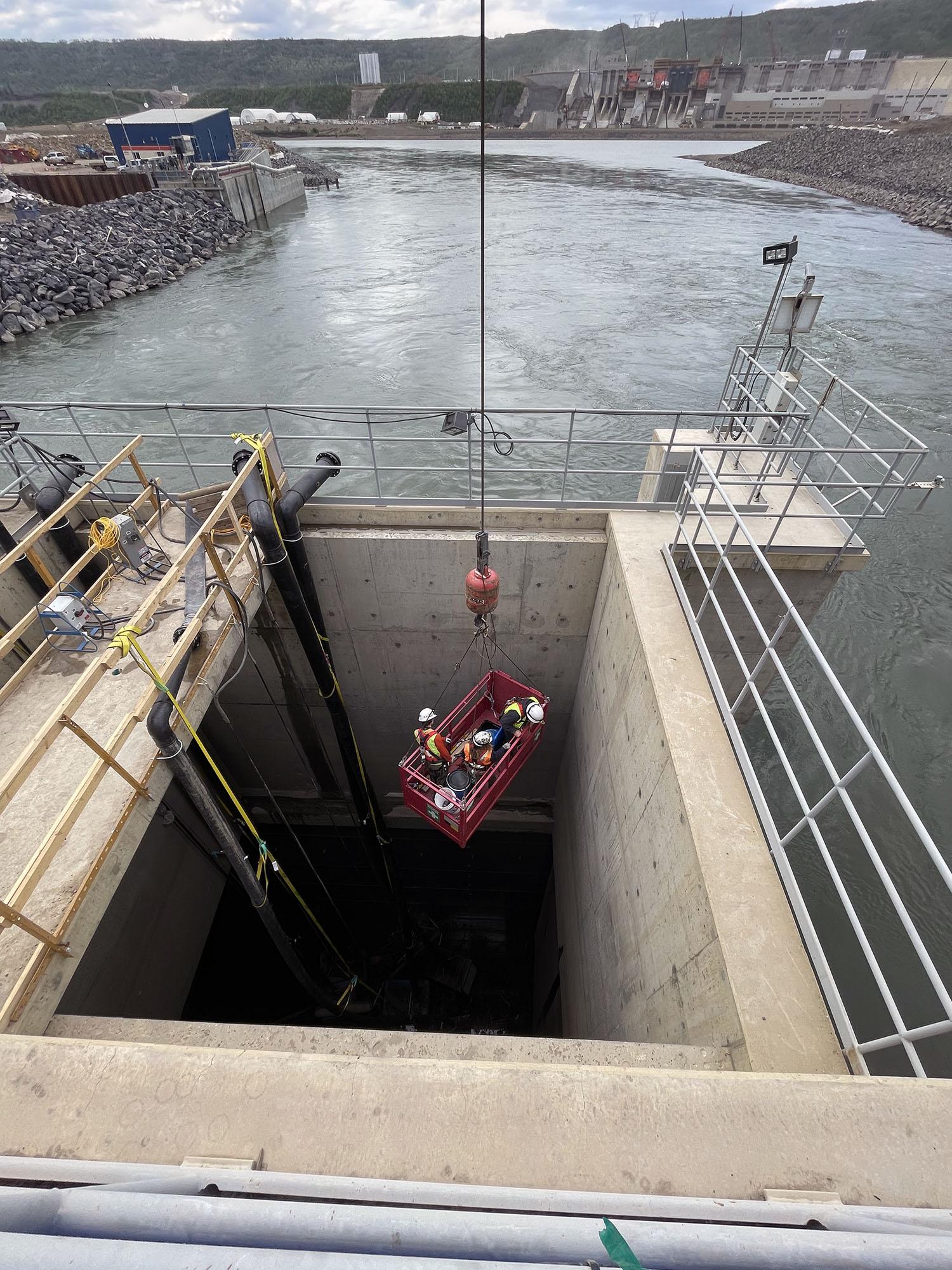
Diversion Tunnel 2 is closed and drained. Technicians then enter the tunnel to rescue any stranded fish and inspect the tunnel. | June 2023
Caption
Diversion Tunnel 2 is closed and drained. Technicians then enter the tunnel to rescue any stranded fish and inspect the tunnel. | June 2023
Media
Image
Media Name
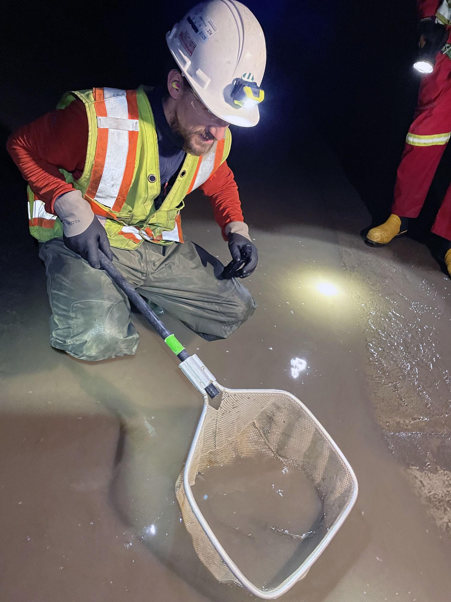
Fish are rescued after the diversion tunnel was closed and drained. | June 2023
Caption
Fish are rescued after the diversion tunnel was closed and drained. | June 2023
Media
Image
Media Name
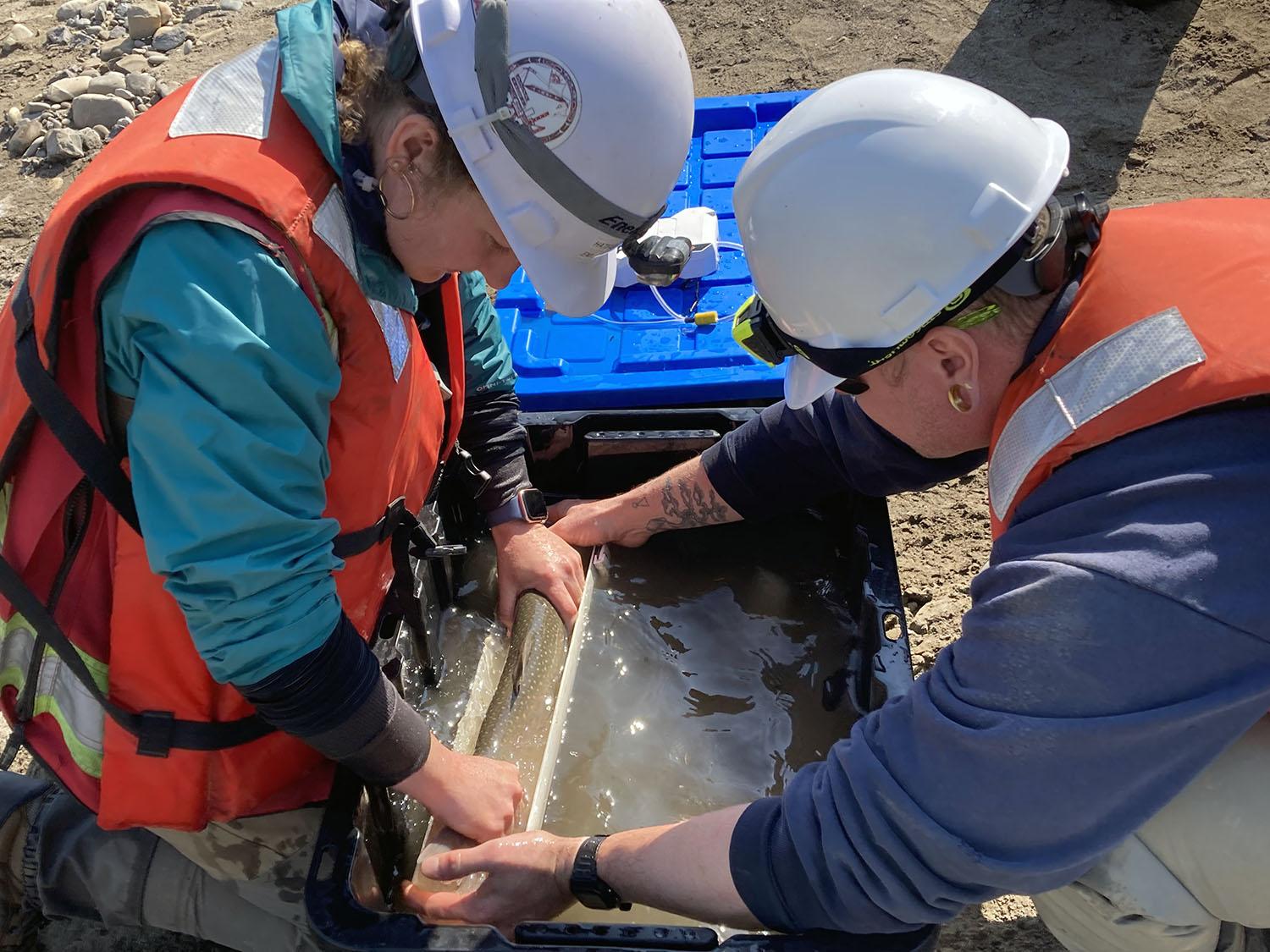
Fish rescued from the tunnel are measured, weighed, and tagged. These fish are then released past the dam. | June 2023
Caption
Fish rescued from the tunnel are measured, weighed, and tagged. These fish are then released past the dam. | June 2023
Media
Image
Media Name
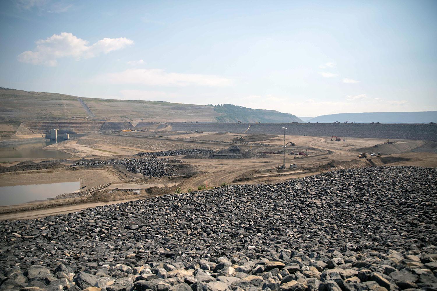
Crews finish the upstream shell of the dam. | June 2023
Caption
Crews finish the upstream shell of the dam. | June 2023
Media
Image

Media Name
North-facing panorama of the approach channel. | June 2023
Caption
North-facing panorama of the approach channel. | June 2023
Media
Image
Media Name
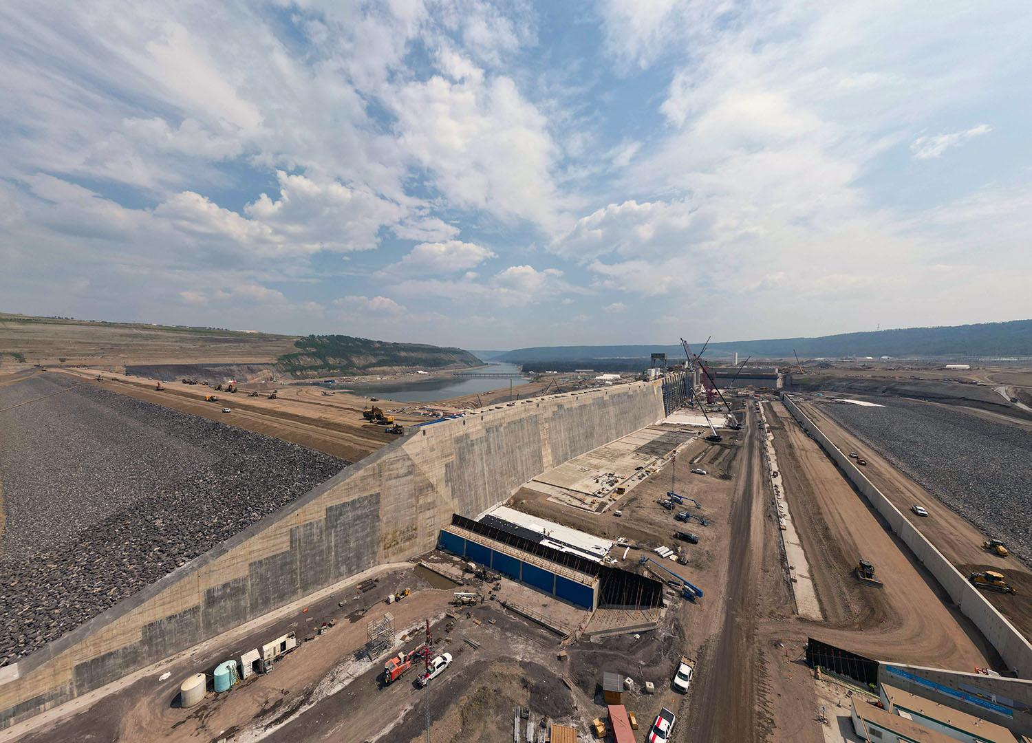
East-facing view up the approach channel where water will flow into the intakes from the reservoir. | June 2023
Caption
East-facing view up the approach channel where water will flow into the intakes from the reservoir. | June 2023
Media
Image
Media Name
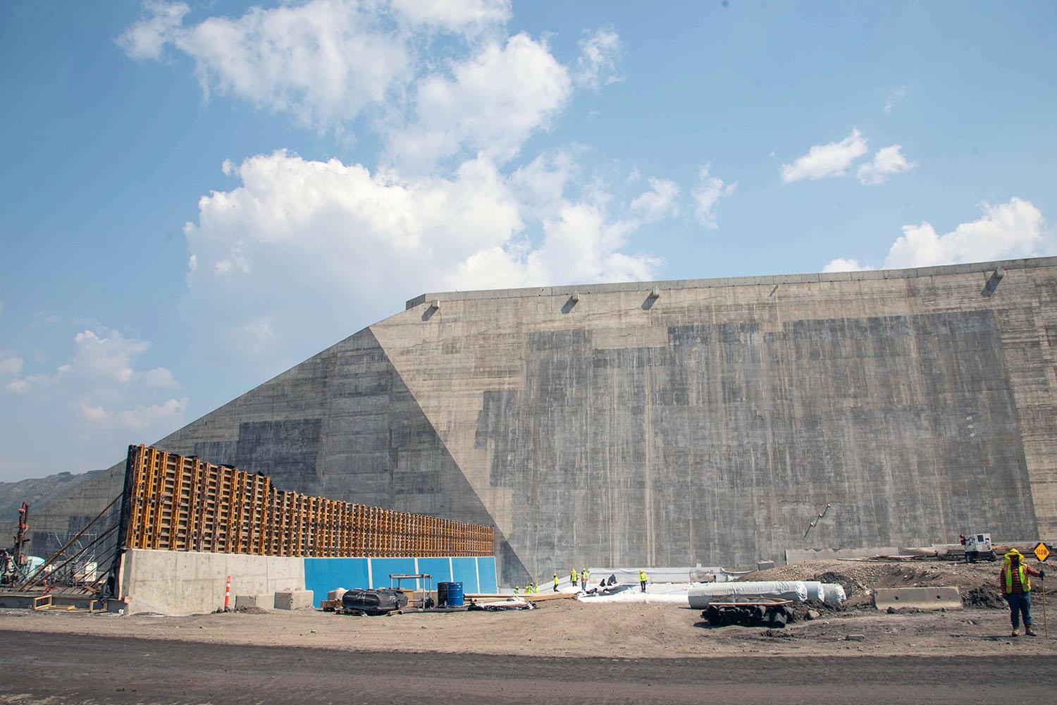
The drainage gallery extension (left) extends into the approach channel from the buttress (back). | June 2023
Caption
The drainage gallery extension (left) extends into the approach channel from the buttress (back). | June 2023
Media
Image
Media Name
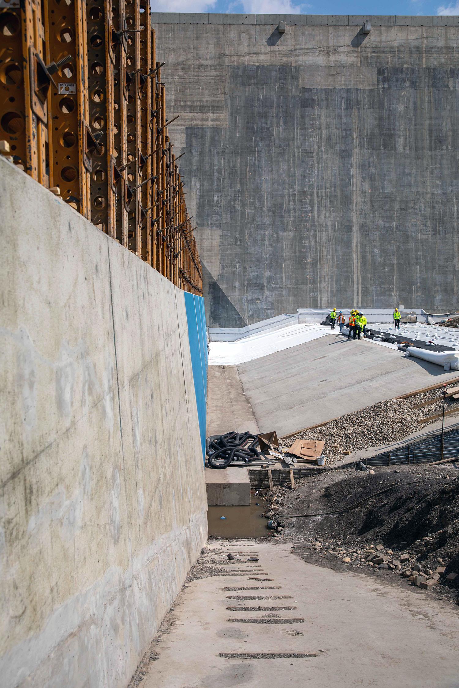
Looking along the drainage gallery extension from the approach channel to the dam and core buttress. This area will be covered with a waterproof liner and backfilled. | June 2023
Caption
Looking along the drainage gallery extension from the approach channel to the dam and core buttress. This area will be covered with a waterproof liner and backfilled. | June 2023
Media
Image
Media Name
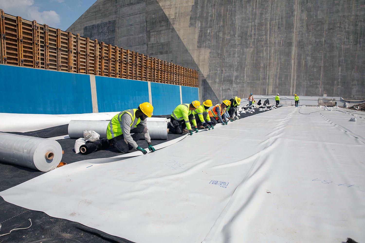
Crews place the waterproof liner in the approach channel. | June 2023
Caption
Crews place the waterproof liner in the approach channel. | June 2023
Media
Image
Media Name
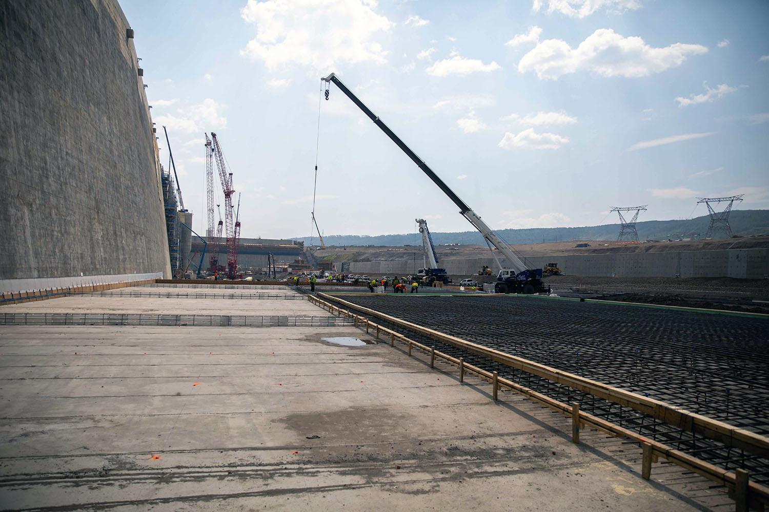
Crews prepare the concrete erosion slabs in the approach channel. | June 2023
Caption
Crews prepare the concrete erosion slabs in the approach channel. | June 2023
Media
Image
Media Name
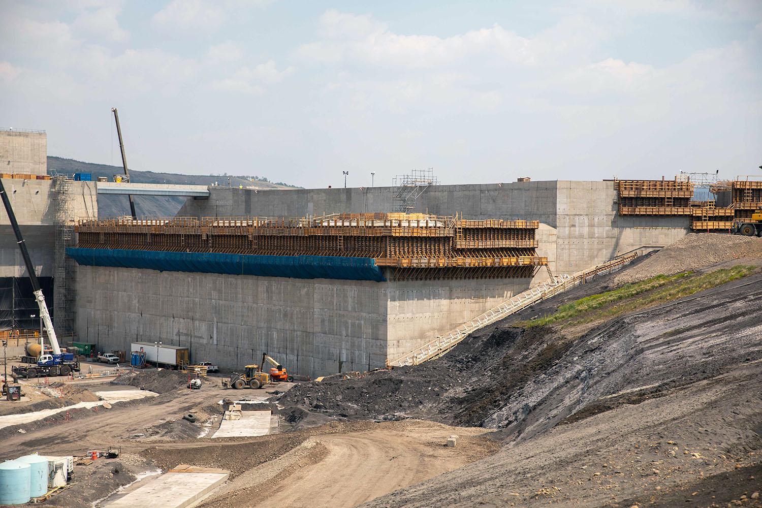
The end wall of the approach channel and the entry to the auxiliary spillway are under construction. | June 2023
Caption
The end wall of the approach channel and the entry to the auxiliary spillway are under construction. | June 2023
Media
Image
Media Name
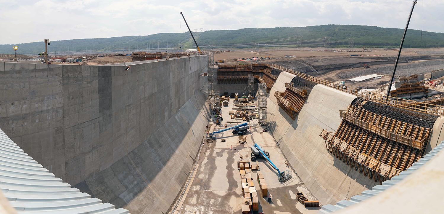
The basin of the auxiliary spillway, which operates without electricity and can safely manage overflow water. | June 2023
Caption
The basin of the auxiliary spillway, which operates without electricity and can safely manage overflow water. | June 2023
Media
Image
Media Name
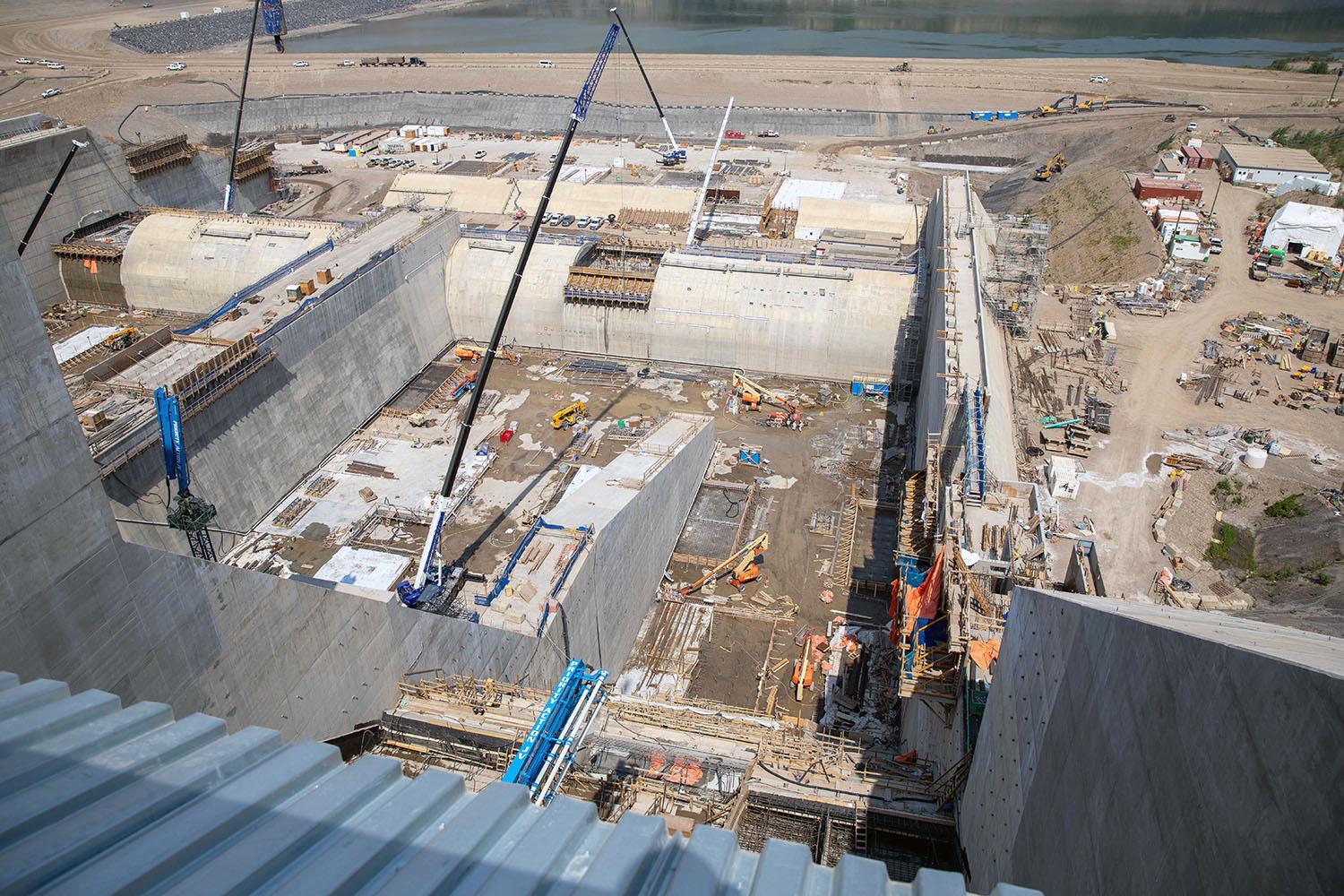
Crews install steel and formworks in the east stilling basin to prepare for concrete placement. Water from the spillways will fill this basin before it flows into the Peace River. | June 2023
Caption
Crews install steel and formworks in the east stilling basin to prepare for concrete placement. Water from the spillways will fill this basin before it flows into the Peace River. | June 2023
Media
Image
Media Name
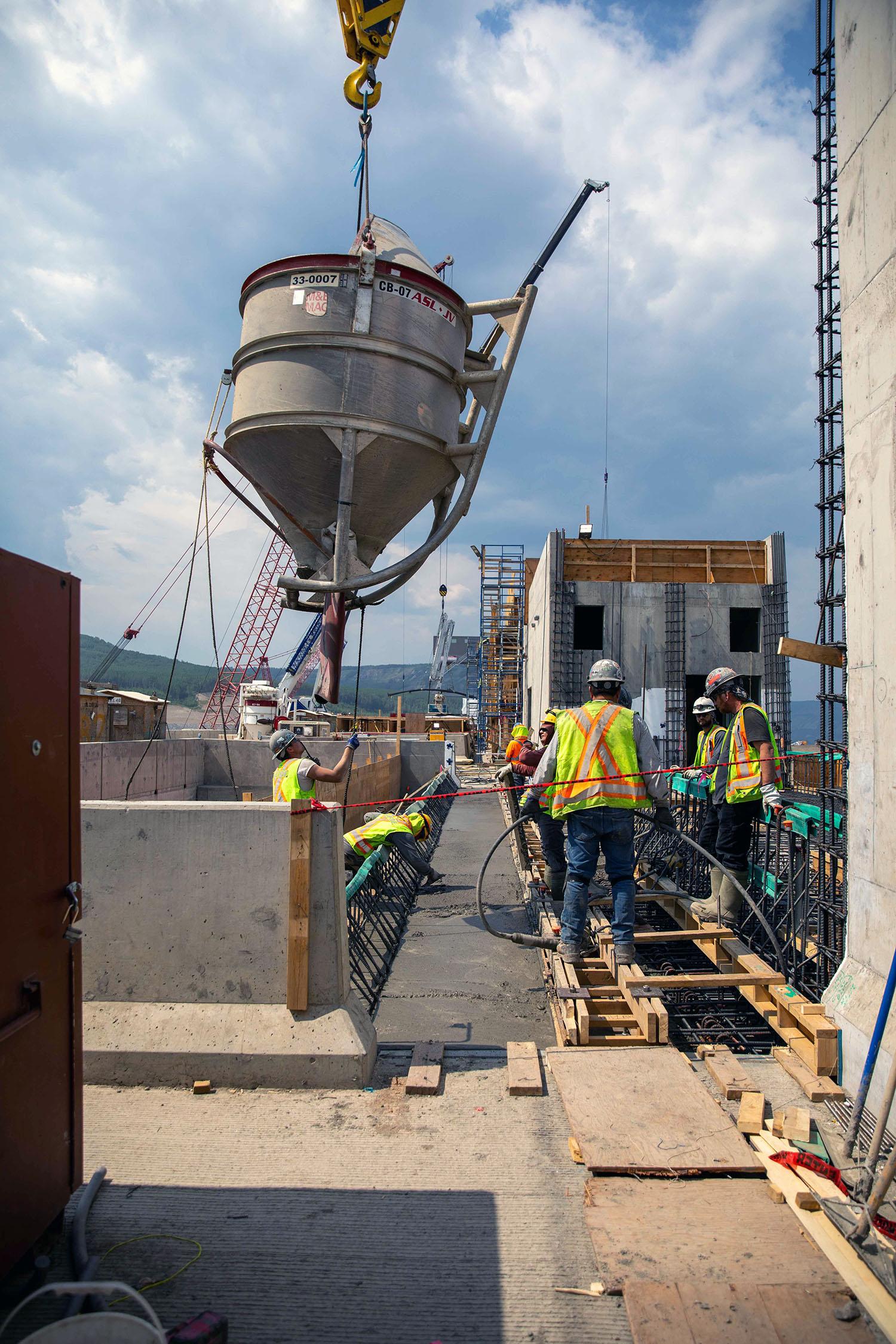
A bucket carries concrete for the top of the spillway headworks. | June 2023
Caption
A bucket carries concrete for the top of the spillway headworks. | June 2023
Media
Image
Media Name
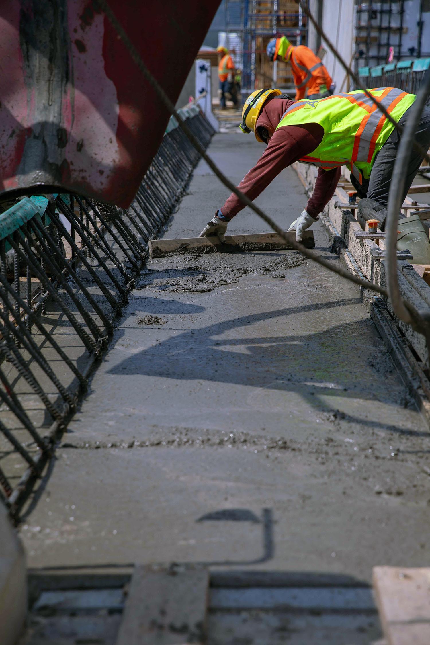
A cement mason uses a screed to level off the freshly placed concrete at the spillway headworks. | June 2023
Caption
A cement mason uses a screed to level off the freshly placed concrete at the spillway headworks. | June 2023
Media
Image
Media Name
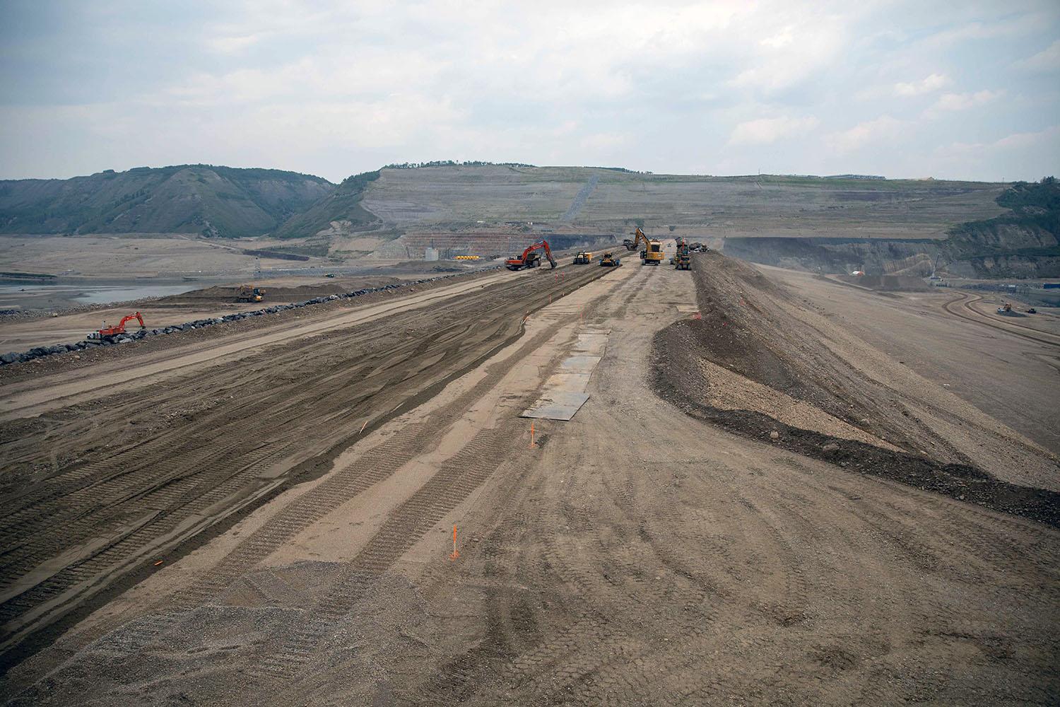
North-facing view across the earthfill dam as it nears completion. | June 2023
Caption
North-facing view across the earthfill dam as it nears completion. | June 2023
Media
Image
Media Name
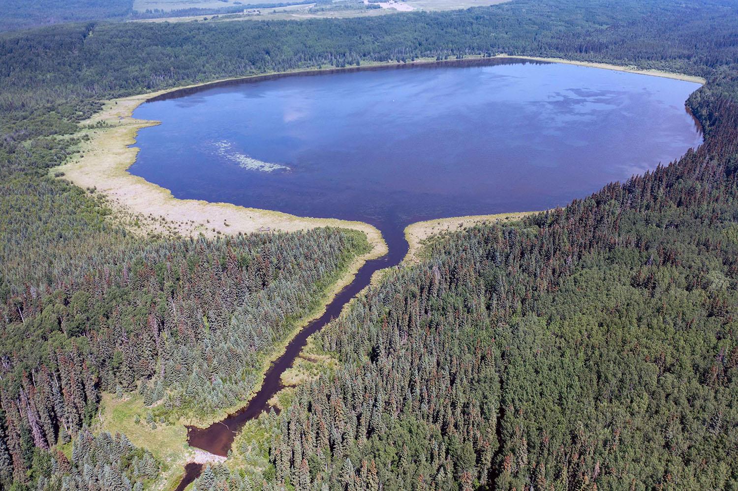
The Scott Lake wetland, 37 km south of Fort St. John, is the latest wetland restoration for the Site C project. It was originally built by Ducks Unlimited in 1988. | June 2023
Caption
The Scott Lake wetland, 37 km south of Fort St. John, is the latest wetland restoration for the Site C project. It was originally built by Ducks Unlimited in 1988. | June 2023
Media
Image
Media Name
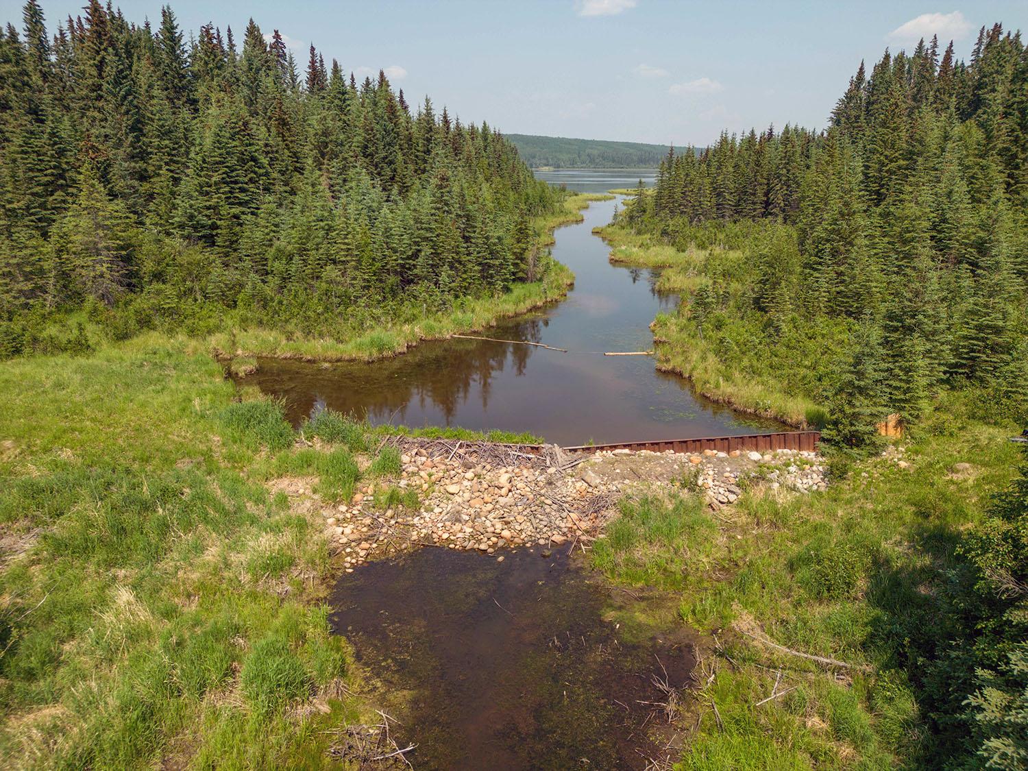
The weir on the Scott Lake wetland will be rebuilt this summer to preserve the 67-hectare wetland that would otherwise be decommissioned. | June 2023
Caption
The weir on the Scott Lake wetland will be rebuilt this summer to preserve the 67-hectare wetland that would otherwise be decommissioned. | June 2023
Order
7.00